Costa Vicentina — Portugal's Wild Atlantic Coast
The Costa Vicentina is what most of Portugal’s coastline used to look like before the 1960s. Development restrictions within the Parque Natural do Sudoeste Alentejano e Costa Vicentina have kept the 120 km between Sines and Burgau largely free of the hotels, beach bars, and permanent infrastructure that line the Algarve. The result is a coast of empty beaches, crumbling cliffs, Atlantic dune systems, and fishing villages that still smell of sardines rather than sunscreen.
What Makes It Different
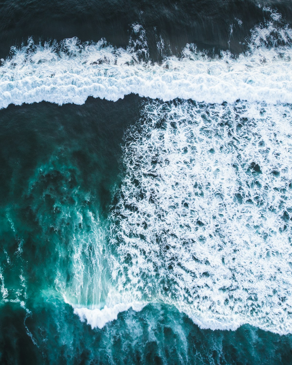
Two things protect the Costa Vicentina: the nature park status (established 1988) which prohibits large-scale construction, and the weather. The prevailing northwest wind blows cold air off the open Atlantic, keeping sea temperatures below 18°C even in midsummer and making the beaches genuinely uncomfortable without a wetsuit for swimming. Surfers love this; sunbathers go to the Algarve instead. The self-selecting effect keeps the coast from being overrun.
The coastline is geologically varied — from the limestone sea stacks south of Sagres (technically at the border of the Wild Coast and the west Algarve) to the long sand beaches and river mouths of the Alentejo north, the dramatic cliff sections near Arrifana, and the dunes north of Porto Covo.
The Rota Vicentina — Walking the Wild Coast
The Rota Vicentina connects Santiago do Cacém (inland) to Cabo de São Vicente at the far southwest tip of Portugal, with two main routes:
The Fishermen’s Trail (Trilho dos Pescadores): 226 km along the clifftops and beaches from Porto Covo to Cabo de São Vicente. The trail uses paths that fishermen historically used to reach the cliff-edge fishing spots. It is genuinely spectacular — long sections have no roads or buildings visible in any direction.
The Historical Way (Caminho Histórico): An inland route of similar length, passing through cork oak forests, farms, and villages.
Both routes are well waymarked and maintained. The Rota Vicentina association (rotavicentina.com) publishes up-to-date trail notes and accommodation lists along the route. Stage lengths are typically 15–25 km, with villages positioned to provide overnight stops. Most walkers complete the full Fishermen’s Trail in 10–12 days.
For shorter walks, individual sections from Zambujeira do Mar to Odeceixe (approximately 17 km), or Arrifana to Aljezur (12 km) are among the best day walks in Portugal.
The Towns and Villages
Vila Nova de Milfontes is the largest and most accessible town on the Alentejo coast — a small fishing town at the mouth of the Mira river, with a castle (now a private residence), a pedestrianised centre, and good fish restaurants. The beaches north and south of the town mouth are extensive and backed by dunes. Ferries cross the river mouth to quieter beaches on the north bank.
Zambujeira do Mar is a small village at the bottom of a cliff path, known mainly for the Sudoeste Primavera Sound festival (held in August, capacity 40,000 — the village of 200 inhabitants briefly becomes one of Portugal’s larger “cities”). Outside festival week, it is very quiet, with one excellent beach and minimal facilities.
Odeceixe sits on the Alentejo-Algarve border, where the Seixe river meets the sea. The village is on a hill above the valley; the beach is 2 km down a road that ends at the river mouth. At low tide, the river is crossable on foot and the beach extends north. The village has a weekly market on Tuesdays and a handful of cafés.
Aljezur is the main town of the northern Algarve’s wild coast section — two neighbourhoods (old Moorish hill, new town in the valley) with a covered market, independent cafés, and easy access to the beaches at Arrifana, Monte Clérigo, and Amoreira.
Arrifana is a surf village below the cliffs, with consistent beach and reef breaks and two surf schools. The ruins of a Moorish fort sit on the headland above the beach. It is the most active surf spot on the coast and can get crowded in summer.
Carrapateira is a small village known for Praia da Bordeira — a vast beach inside a dune system with a river that curves across the sand. The dunes here are among the tallest on the Portuguese coast and the beach’s northern exposure picks up powerful Atlantic swells.
Surfing
The Costa Vicentina is the most consistent surfing coastline in Portugal. The northwest-facing beaches pick up North Atlantic swell from September to May; summer is calmer but waves still run. Key breaks:
- Arrifana — beach and reef break; good for intermediate surfers; surf schools available
- Praia do Amado — wide beach near Carrapateira; powerful beach break; beginner-friendly sections
- Odeceixe — sheltered from north winds; good for beginners
- Praia da Bordeira (Carrapateira) — powerful beach break, best for experienced surfers
- Sagres — multiple breaks including Tonel and Mareta; year-round consistency
Water temperature runs 14–18°C year-round. A 4/3mm wetsuit is appropriate for most of the year; a 3/2mm is usable from June to September for those who tolerate cold water.
Practical Notes
Getting there: A car is essential for exploring the coast flexibly — hire a car at Faro airport and drive north, or pick up from Lisbon. The nearest airport is Faro (Algarve), 2 hours from Vila Nova de Milfontes. Lagos (Algarve) is the best base if arriving by train. Bus connections from Lisbon reach Odemira and Sines; local buses to beach villages are infrequent. Our 7-day Algarve road trip devotes Days 4 and 5 to the Costa Vicentina section, with a structured route from Sagres north to Vila Nova de Milfontes and Porto Covo.
Accommodation: Book well in advance for July and August. The Rota Vicentina website lists accommodation along the walking routes including rural guesthouses and surf camps. Wild camping is not permitted within the nature park.
Water: Sea temperatures are cold year-round by Mediterranean standards. What feels cold to most swimmers feels excellent to surfers. Even in August the water rarely exceeds 18°C at Arrifana.
Facilities: Do not expect beach bars, lifeguards, or phone signal at the more remote beaches. Bring water and food; the coast is raw by design.
Related Guides
For detailed surf reports by break — Arrifana, Bordeira, Odeceixe, and Monte Clérigo — see our Costa Vicentina surf guide. The southern end of the coast connects directly to the Algarve region via Sagres; the Sagres surf guide covers the peninsula’s breaks. Heading north, the Alentejo interior is covered in our Alentejo region guide — useful for those combining the coast with Évora, Monsaraz, and the wine estates. For dolphin watching boat trips that operate along this coast, see our dolphin watching Algarve guide.
Book an experience
Region Guide in the area
Best price guaranteed · Instant confirmation · Free cancellation on most bookings
Frequently Asked Questions
- What is the Costa Vicentina?
- The Costa Vicentina is the Atlantic coastline of the southwest Alentejo and western Algarve, protected within the Parque Natural do Sudoeste Alentejano e Costa Vicentina. It runs approximately 120 km from Sines in the north to Burgau in the south. Development is tightly restricted — no high-rise hotels, no beach clubs, limited signage.
- Can you surf on the Costa Vicentina?
- Yes — it is one of Europe's best surfing coastlines. Arrifana, Odeceixe, Praia do Amado, and Carrapateira all have consistent Atlantic swells year-round. The coast faces northwest and picks up North Atlantic swell reliably from September to April. Surf schools operate in Arrifana and Vila Nova de Milfontes.
- What is the Vicentina Walking Route (Rota Vicentina)?
- The Rota Vicentina is a network of walking trails covering 450 km of the southwest coast. The Fishermen's Trail (Trilho dos Pescadores) follows the clifftops and beaches from Santiago do Cacém to Cabo de São Vicente — 226 km. The Historical Way (Caminho Histórico) runs inland. Sections can be walked independently with accommodation at villages along the route.
- Is there accommodation on the Costa Vicentina?
- Yes, but limited by design — the nature park status restricts new construction. Vila Nova de Milfontes, Zambujeira do Mar, Odeceixe, and Aljezur have guesthouses, surf camps, and small hotels. Booking well in advance is essential in July and August. Camping is permitted at designated sites.
Car Hire
Hire a Car in Portugal
The Alentejo, Algarve, and the north are best explored by car. GetRentacar compares local and international suppliers to find the best available rate.
Compare Car Hire →Same price as booking direct — we earn a small commission at no extra cost to you.